News Center
Unlocking Accurate Navigation: Understanding Satellite Compass Heading
Unlocking Accurate Navigation: Understanding Satellite Compass Heading
Table of Contents
- 1. Introduction to Satellite Compass Heading
- 2. What is a Satellite Compass?
- 3. How Does a Satellite Compass Work?
- 4. Benefits of Using Satellite Compasses
- 5. Applications of Satellite Compasses in Various Industries
- 6. Challenges and Limitations of Satellite Compass Technology
- 7. Future Trends in Navigation Technology
- 8. Frequently Asked Questions
- 9. Conclusion
1. Introduction to Satellite Compass Heading
In today’s fast-paced world, accurate navigation is crucial for numerous applications, ranging from personal travel to maritime operations. **Satellite compass heading technology** significantly enhances navigation precision by leveraging satellite signals to determine orientation. This article aims to unravel the complexities of satellite compass headings, emphasizing their importance and application in modern navigation.
2. What is a Satellite Compass?
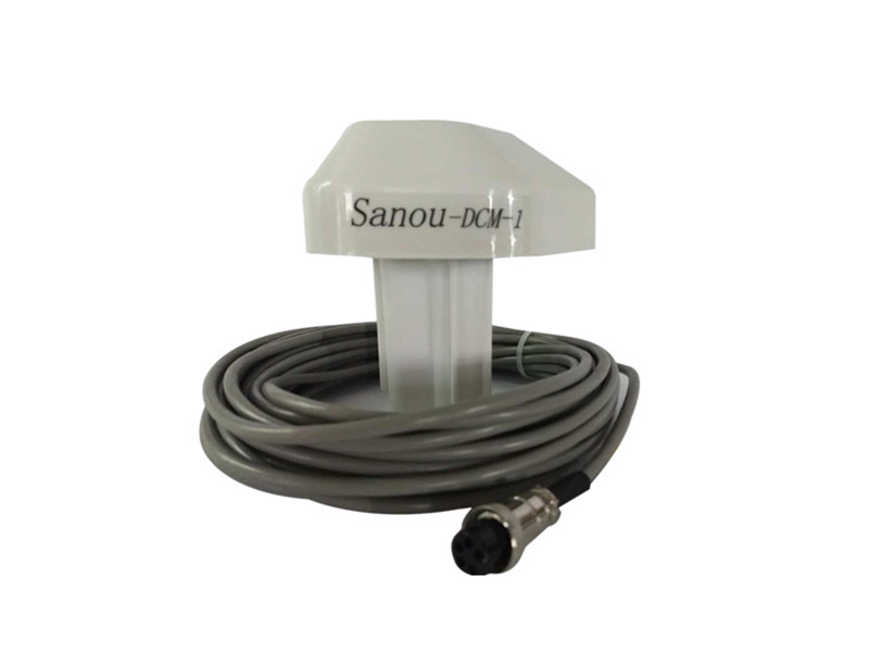
A **satellite compass** is an advanced navigation tool that utilizes signals from satellites to ascertain the directional heading of an object. Unlike traditional compasses that rely on the Earth's magnetic field, satellite compasses provide a more accurate and reliable means of navigation, especially in environments where magnetic interference may occur. They are integral to systems such as GPS (Global Positioning System) and GNSS (Global Navigation Satellite System).
2.1 Key Components of Satellite Compasses
Understanding the fundamental components of a satellite compass helps clarify its operational mechanics. The primary components include:
- **Satellite Signals**: These are radio signals sent from satellites in orbit, which the compass receives to determine location and heading.
- **Inertial Measurement Units (IMUs)**: Many satellite compasses integrate IMUs to enhance heading accuracy by measuring angular velocity and acceleration.
- **Processing Software**: This software interprets the data received from satellites and IMUs, converting it into usable navigation information.
3. How Does a Satellite Compass Work?
Satellite compasses operate on the principle of triangulation, utilizing signals from multiple satellites to calculate precise positioning and heading. Here's a step-by-step breakdown of the process:
1. **Signal Reception**: The compass receives signals from at least four satellites to establish a three-dimensional position.
2. **Data Processing**: The onboard processing unit calculates the time it took for signals to arrive, allowing it to calculate distance from each satellite.
3. **Heading Calculation**: By analyzing the relative positions of the satellites, the system can determine the device's heading with remarkable accuracy.
4. **Correction Algorithms**: Advanced algorithms are employed to correct for any potential errors caused by atmospheric conditions, satellite drift, or other factors affecting signal quality.
4. Benefits of Using Satellite Compasses
Utilizing a satellite compass offers numerous advantages over traditional navigation methods:
4.1 Enhanced Accuracy
One of the primary benefits of satellite compasses is their ability to provide **highly accurate position and heading information**. This accuracy is vital for tasks that require precise navigation, such as aviation and maritime operations.
4.2 Reliability in Various Conditions
Satellite compasses function effectively in diverse environments, including urban areas where traditional compasses may falter due to magnetic interference. Their reliance on satellite signals ensures reliable performance under challenging conditions.
4.3 Global Coverage
With a network of satellites orbiting the Earth, satellite compasses offer **global coverage**, making them suitable for navigation in remote or isolated areas.
5. Applications of Satellite Compasses in Various Industries
The versatility of satellite compasses allows their integration into various industries, enhancing navigation capabilities across the board:
5.1 Maritime Navigation
In maritime operations, satellite compasses are critical for accurate course plotting and collision avoidance. They enable vessels to navigate safely through challenging waters, ensuring efficient and safe operations.
5.2 Aviation
Aviation relies heavily on satellite navigation systems for flight planning, route optimization, and landing procedures. The precision of satellite compasses plays a pivotal role in enhancing flight safety and efficiency.
5.3 Land Surveying
Land surveyors utilize satellite compasses to achieve high levels of accuracy in mapping and property boundary determination. This technology facilitates efficient data collection and analysis.
5.4 Autonomous Vehicles
As autonomous vehicle technology continues to advance, satellite compasses are becoming essential for navigation and obstacle avoidance. They help vehicles determine their position and heading in real time, improving safety and reliability.
5.5 Personal Navigation
Consumers increasingly rely on satellite compasses for personal navigation through smartphones and GPS devices. These tools enhance the travel experience by providing accurate directions and location information.
6. Challenges and Limitations of Satellite Compass Technology
While satellite compasses provide numerous benefits, they are not without challenges:
6.1 Signal Loss
Satellite signals can be obstructed by dense urban environments, mountains, or adverse weather conditions. This can lead to temporary loss of accuracy or complete signal loss.
6.2 Dependency on Satellite Infrastructure
The effectiveness of satellite compasses is contingent upon the availability and functionality of the satellite network. Any disruptions in satellite operations can directly affect navigation accuracy.
6.3 Cost
The initial investment in satellite compass technology can be significant, particularly for advanced systems used in professional applications. This can be a barrier for smaller enterprises or individual users.
7. Future Trends in Navigation Technology
As technology continues to evolve, several trends are shaping the future of satellite navigation and compasses:
7.1 Integration of AI and Machine Learning
The integration of artificial intelligence (AI) and machine learning will enhance the capabilities of satellite compasses, allowing for improved data analysis and predictive navigation modeling.
7.2 Enhanced Security Measures
With the growing concern about security in satellite navigation, future developments will focus on implementing robust security measures to protect against signal jamming and spoofing.
7.3 Miniaturization of Technology
As technology advances, we can expect smaller, more efficient satellite compass units that can be embedded in a wider range of devices, making accurate navigation accessible to more users.
8. Frequently Asked Questions
8.1 What is the difference between a satellite compass and a traditional compass?
A satellite compass uses signals from satellites for navigation, while a traditional compass relies on the Earth’s magnetic field. This makes satellite compasses more accurate and reliable in various conditions.
8.2 How accurate are satellite compasses?
Satellite compasses can provide accuracy within a few meters under ideal conditions, making them suitable for precise navigation tasks.
8.3 Can satellite compasses be used indoors?
Generally, satellite compasses are less effective indoors due to signal obstruction. However, some advanced systems can use additional sensors to enhance indoor navigation.
8.4 Are satellite compasses affected by weather conditions?
While satellite compasses can operate in various weather conditions, extreme weather such as heavy rain or snow can affect signal quality and accuracy.
8.5 How do I choose the right satellite compass for my needs?
When selecting a satellite compass, consider factors such as accuracy requirements, environmental conditions, integration capabilities, and budget.
9. Conclusion
In conclusion, satellite compass heading technology represents a groundbreaking advancement in navigation accuracy and reliability. By understanding how satellite compasses work and their applications across various industries, we can appreciate their significant role in modern navigation. As we continue to innovate and improve this technology, the potential for enhanced navigation experiences will only grow, paving the way for safer and more efficient travel in our increasingly connected world. Embracing satellite compass technology is not just a trend; it's a crucial step toward the future of navigation.
Related News
Understanding the Importance of the Furuno 1831 Radar Plug: A Comprehensive Guide
The Furuno 1831 radar plug, especially the 24-pin square variant, is a crucial component when it comes to radar level measurement in various industries. Understanding its significance can enhance the functionality and reliability of radar systems, which are vital for applications such as shipping, oil and gas, food processing, and many other sectors where precise measurements of levels are essenti
Case Studies: Successful Implementation of 12KVA Frequency Stabilizers in Power Distribution
Case Studies: Successful Implementation of 12KVA Frequency Stabilizers in Power Distribution Table of Contents Introduction to 12KVA Frequency Stabilizers The Importance of Frequency Stabilizers in Power Systems Case Study 1: Manufacturing Sector Case Study 2: Healthcare Facilities Case Study 3: Data Centers Case Study 4: Telecommunications Industry Common Benefits of
Understanding the Furuno 1832 Radar Motor: A Key Component in Marine Electronics
The Furuno 1832 radar motor is a component of Furuno's radar systems, which are widely recognized for their reliability and effectiveness in marine environments. Radar technology plays a pivotal role in ensuring safe navigation by detecting objects, such as other vessels, landmasses, and navigational hazards, which may not be visible to the naked eye, especially in adverse weather conditions. At t


